Showing posts with label Merrimack River. Show all posts

Sunday, November 6, 2011

Merrimack River Kayaking Trip - Scruender Park, Methuen to Pines Recreation Area, Groveland


View Methuen to Groveland in a larger map

After the freak snowstorm we had last weekend I thought my kayaking season might be over.  But the weather warmed up enough for me to get out on the Merrimack this morning.   Temperatures were in the high 40s when I put in but quickly warmed up to the mid 50s, pretty comfortable kayaking weather.  Wind was pretty light but picked up a bit toward the end of my trip.

I was looking forward to some foliage paddles this season but I somehow seemed to miss it.  Colors now appear to be varying shades of yellow.  I was hoping with most of the leaves gone from the trees I might see an eagle in the trees but none seemed to be around this weekend.  There was a lone Great Blue Heron, some cormorants and ducks still hanging out.  Water levels are still pretty high with a brisk current I am paddling at an average of 5 mph.

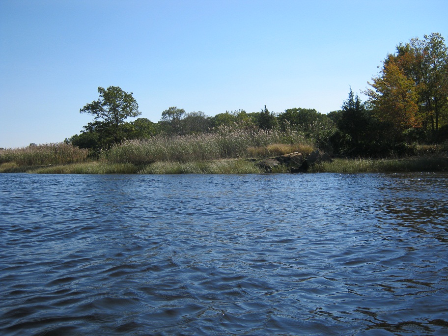
I paddled around the back side of a small island just past the 2nd 495 bridge and found myself in a short narrow little area (below) that reminded me a bit of the Ipswich River.  It was pretty shallow so I am not sure this section could be paddled in the summer but it was nice to get out of the sun and wind for a few minutes.

My destination for this trip was the Pines Recreation Area boat ramp in Groveland.  I stopped here for a break on a trip a few weeks ago and chatted up an older gentleman working there.  I think the ramp is for Groveland residents only but I couldn't find any information on it.  The ramp was gated off for power boats but no problem for someone carrying a kayak.  There is a nice flat ramp and  parking area just a short walk away.  My typical takeout is at Riverside Park in Haverhill.  The problem there is you need to climb a fairly steep flight of stairs to get to the parking lot.  Not always an easy feat after a couple hours of paddlng.  The Pines Recreation Area is just about a mile past the Haverhill and I may try using it again in the future as long as nobody kicks me out as I am not a Groveland resident.

Pines Recreation Area

Total mileage of this trip was just over 10 miles and I completed the trip in 1 hour and 50 minutes. 

Sunday, October 23, 2011

Merrimack River Kayaking Trip - Mouth of the Merrimack Seal Paddle


View Mouth of the Merrimack in a larger map

I have been wanting to get out into the mouth of the Merrimack for a while now but have been a bit hesitant to get out there without someone with some experience.    This area is a large tidal expanse that can get a bit dangerous when the tides are coming in or going out.  I recently found that Plumb Island Kayak offers guided tours of the area and one of the tours even makes a trip out to see some seals.  So I gave the guys at Plumb Island Kayak a call and they told me they had some availability in a tour going out Sunday afternoon.
Pu in / Take out

The put-in for this trip was a private ramp right behind Plumb Island Kayak.  This trip is usually planned just before low tide so as to ride the tide out to the seals and the tide the incoming tide back.  I would be paddling with a group of about 15 college students and there were 4 guides on the trip.  Weather today was a little cool - mid 50s  but there was no wind, pretty much perfect conditions.
First Seal Sighting

Our destination was Badgers Rocks where the seals tend to congregate at this time of the year.  We headed out across the river to the Salisbury side and hugged the shore for about three miles as we headed toward badgers Rocks.  As we approached the rocks we could see at least a dozen seals on the the rocks.  We approached slowly but as we got closer the seals ungracefully made their way off the rocks and into the water.  As we just drifted past we would see numerous little heads popping up to check us out.  We drifted around in the area for about a half hour and just watched the seals popping up and down.   Every once in a while one of the would slap its tail at us warning us that we were too close.   

Close up of a big guy


Soon the sun was going down and it was getting cold so the group headed back.  Total distance of this trip was just over 6 miles and we were out on the water for about 2 and a half hours.  This was a great late season trip, definitely will be paddling this section of the river again. 

View of the Mouth looking toward the ocean

Sunday, October 16, 2011

Merrimack River Kayaking Trip - Methuen to Haverhill

With the weather calling for 20 - 25 mph winds this morning I wasn't planning on any kayaking.  But knowing my opportunities for paddling this season are getting short and the cool crisp air and blue skies calling my name I headed out.   This section of the river is my go to paddle if I am just looking to get out for a couple hours.  Total distance of this trip is just over 9 miles and it usually takes me about an hour and forty five minutes depending on how much I stop to admire the scenery.

My put in for this trip was Scruender Park in Methuen.  Water levels are still very high and thus the current is strong making for an average speed of 5.2 mph (based on my gps).  I thought about paddling upstream a bit but a taste of headwind in my face and I quickly thought better of it.  The wildlife on the river was pretty sparse today.  I saw a couple cormorant, a few pairs of ducks and a lone great blue heron.   Unfortunately no eagle sightings today.


One would think by mid October the foliage would be in full bloom but the trees really seem to be holding onto their green this year.  After turning the corner about halfway through the trip the wind was no longer at my back so I hugged the shore for a bit of shelter.  I soon found my self in downtown Haverhill and paddled past workers at the marina disassembling the piers for the season,

Landing at my take out at Riverside park I was glad to be landing at low tide and have a but of shoreline to land my kayak.  The last few trip this year have all been at high tide where the water covers the bottom of the steps making it a bit precarious to get out of the boat without getting wet.

Hopefully the the weather will cooperate and I can get a couple more trips in this season.  Otherwise I may just have to invest in that wetsuit I have been looking at....

Monday, October 10, 2011

Merrimack River Kayaking Trip - Scruender Park, Methuen MA to Cashman Park, Newburyport MA


One of the reasons that I purchased my Perception Avatar kayak was so that I could take longer trips.  Anything over 10 miles in my 11 foot Necky and I was done.  One trip in particular that I was looking forward to is the trip from Schruender Park in Methuen to Cashman Park in Newburyport.  I have paddled this stretch of river in two separate trips but it had been my goal to paddle the entire stretch as a day trip.  Total mileage of this trip is just about 23 miles so it is a trip that takes a bit of planning including leaving a car in Neburyport or having someone who will pick you up.  For me the one good thing about having a wife that doesn't really like to kayak is she is always available to pick me up at the end of my trips.

Due to the increasing boat traffic after Haverhill I didn't want to attempt this trip during the summer.  I have been warned that things can get pretty crazy downstream with all of the marinas.  You also need to time the tide right so you are not paddling against and incoming tide.  The rule of thumb is to hit Haverhill just about at high tide. 

This past Sunday everything seemed to line up perfectly for my trip with a high tide at about 10:30am.  I put in in Methuen around 9:00am, weather was cool with no wind and forecast to warm up to the mid 80s later in the day.  The first 10 or so miles of my trip went great I was making good time but I did notice that my kayak seemed to be pulling to the left a little.  I assumed I must have bent the skeg a little at put in, something I could straighten out when I stop for lunch.  Once I got past Haverhill the boar traffic started to pick up significantly no doubt because of the unseasonably warm weather.  A bad omen was the three large and extremely loud powerboats like the one below that screamed past me.

At about the 15 mile mark my left arm was really starting to get sore from correcting strokes needed due to the bent skeg so I decided to stop for lunch and see what I could do about it.  I was able to straighten it out a bit but it was still pulling a little but I decided to power on.  Boat traffic continued to increase as I headed downstream making crossing the river a bit precarious.  I wanted to be on the left side of the river when I got to the Route 95 bridge so I could paddle north around the islands in Newburyport / Salisbury,  The last time I paddled this section I was on the right side of the river and wasn't able to get across due to the strong current and tide. 

This time around I was able to stay north of the islands and was treated to less boat traffic and some really nice scenery along Deer, Eagle, Carr and Ram Islands.  Quite a contrast to the marinas and the hundreds of boats on the other side of the islands.  I planned to paddle north around Ram island but was pretty tired at this point so I cut between Carr and Ram Island headed across the Mariana and into the boat Launch at Cashman Park to finish up my day.

Eagle Island

Carr Island

Between Carr and Ram Island heading toward Cashman Park

Total mileage of my trip was just under 23 miles and I was on the water for just over 5 hours.  I have some pretty sore arms and shoulders today but I am glad to have completed the trip at least just to say that I did it.  The area around the islands in Newburyport is really nice.  If I wasn't so tired at the end of my trip it would have been nice to explore a little.  I guess that will have to be a trip for next season.

Monday, September 26, 2011

More On The Hooksett Wastewater Treatment Plant Disks

There were a couple interesting articles in the Lawrence Eagle Tribune this week about the spill this past March that released millions of plastic waste water filtration disks into the Merrimack River.  The first article is about the steps they are taking in Hooksett to prevent something from happening again.

Taking steps to prevent another disk incident in the Merrimack

The second article is about a gut from Merrimack MA who has picked up 12,000 of the disks on a short stretch of the river.

The 12,000 Disk Man

Sadly, despite the new measures put in place and the cleanup efforts of many I fear we will be finding these disks in and along the Merrimack for years to come.

Tuesday, August 23, 2011

Kayak 3 Rivers in 5 Miles - Merrimack, Spicket and Shawsheen


View Shawsheen and Spicket Rivers in a larger map

At the end of last season I attempted to paddle upstream on the Merrimack River to the mouths of the Spicket and Shawsheen Rivers.  They are on opposite sides of the river about 2 miles upstream from where I put in at Schruender Park in Methuen.  On my last attempt the water level was too low so I was only able to look from a distance at these rivers.  Over the last couple weeks we have gotten quite a bit of rain which seems to have replenished the river levels quite a bit.  So I decided this past Sunday to make another attempt to paddle upstream on the Shawsheen and Spicket rivers.

I strapped my kayak to my cart nice and early and hiked down the street to my put in at Schruender Park in Methuen.   As expected the water levels were higher that they were a few weeks ago and after just a few minutes of paddling against the current I could feel it in my arms.  But I pushed through it and continued about 2 miles upstream to the mouth of the Spicket River.  I was glad to see that there was indeed enough water flowing so I would be able to paddle upstream for at least a short distance.  I was pretty disturbed by the amount of trash deposited along the banks, tires, auto parts, appliances, pretty sad actually.   
Mouth of the Spicket River
After paddling about 200 yards upstream I encountered a sand bar that I needed to portage over and another 100 yards or so I encountered another shallow portion that I considered portaging over as well but looking upstream it looked like I would be doing more portaging than paddling so I decided to turn around , head back downstream and see what the Shawsheen River had to offer.  There were a couple interesting features in this section of the Spicket river.  First being the discharge waterfall of the lawrence canal.  The seconsd was the very large pipe that ran under the Canal Street bridge.  Not sure wat that pipe carries or once carried but it was huge.  I was a bit disappointed that I was only able to paddle about 300 yards upstream but I was glad to have at least done that.

Lawrence Canal discharge

Upstream toward Canal Street Bridge
Under the Canal Street Bridge looking downstream
The mouth of the Shawsheen river is interesting in that in order to get through it you need to paddle through a 200 yard tunnel.  There are actually three tunnels side by side so you have a choice of which one to paddle through.  I sat in front of them for a few minutes contemplating if I really wanted to paddle through and if so which one.  Finally I decided to just pick the one in the middle and went for it.  I have to say it was pretty damn creepy.  You at least have the light at the other end of the tunnel to guide you but when you get to the 100 yard mark it is very dark.  At one point my paddle caught on something which felt like something pulling on, this really freaked me out.  Needless to say I picked up the pace and eventually made it to the other end and daylight.
Tunnels at the mouth of the Shawsheen River
Daylight!!!! Other side of the tunnel
After paddling through the tunnel I was able to paddle another 250 or so yards until I encountered some rocks and quick water just under the Haverhill commuter rail bridge.  Not feeling much in the mood for any more portaging I turned around headed back downstream through the same middle tunnel I came through and headed for home.  The trip back through the tunnel was uneventful but no less creepy.
End of the line on the Shawsheen River
On the way home I decided to hug the shoreline a bit in hopes of another bald eagle sighting, I was not to be disappointed.  About a mile downstream a beautiful mature bald eagle took off from a branch above my head.  I did not have my camera ready but I watched as he soared a few hundred yards downstream and flew into the trees.  So I readied my camera and continued hugging the shore paddling downstream just in case he decided to surprise me again.  Just as I was thinking I missed him he popped out just above my head again but I had my camera ready this time.  Not a great shot but if you click on the picture below you can see the white on his tail.


Total mileage of this trip was about 5 miles and I was on the water for just under 2 hours.  I was really hoping to be able to paddle further upstream on the Spicket and Shawsheen Rivers but I am beginning to think it may only be possible in the early Spring.  Overall a nice little trip the highlight being my second trip of the year seeing a bald eagle.

Sunday, July 31, 2011

Merrimack River Kayak Trip - Lawrence MA to Bradford MA

View Merrimack River - Lowell to Bradford in a larger map

I attended another trip today with the MRWC.  This trip was on my home turf as it would take us right past my usual put-in in Methuen.  I have paddled this section of the river many times but this was my first time using the put in and take out that we used for this trip.

Boat Launch at Pemberton Park, Lawrence MA
Merrimack River just below the Great Stone Dam Lawremce MA

We started the trip at the boat launch Pemberton Park in Lawrence. This launch is just below the Great Stone Dam.   The ramp itself is very nice and is in pretty good shape.  There is a small beach area at the bottom of the ramp that was great for launching kayaks.  The park leading to the ramp was another story,  There were numerous homeless people living in the park and what appeared to be other illicit activity going on.  Nobody bothered us but I would not be really comfortable leaving my car there for an extended period of time.


After shuttling our cars to the takeout we were underway.  The first mile and a half of this trip takes you through downtown Lawrence.  There are large mills on both sides of the river in this section.    This section is also where the Spicket River empties into the Merrimack on river left and the Shawsheen on River right,  At about this one and a half mile mark we passed under route 495.  Once under this bridge the banks of the river appear much more rural with mostly wooded banks for the next 6 or so miles.  The river is pretty wide but the current does give you a nice little push.  Currently though the river is very low.  Lower than I have seen it in some time, so the current was not helping too much.  The low level also reveals the rocky bottom.  There are several rock gardens to navigate as most of us found as we slid over or just heard the thud of the rocks hitting out boats.  There is one short section of quick water once past the island at the 6 mile point but because of the low water level it wasn't as quick as it is at other times of the year.


The highlight of this trip had to be our bald eagle sightings.  I have paddled this section of the river at least a half-dozen times over the past couple years and I have never seen an eagle.  I have always wanted to and I was told they are out there but they have always eluded me....until this trip.  We saw four eagles and I couldn't have been more excited.  The first two were pointed out to be by another paddler.  They were soaring very high above us and if someone had not said something I probably would have just though they were hawks.  But as I looked closer I could definitely see the telltale white tail and head.  I snapped a picture but they were so high they just look like a dot unless you zoom way in on the picture.  See above.  I would have been satisfied with the first sighting but a few miles downstream another eagle flew over our heads at treetop height.  If that weren't enough another mile downstream we watched an immature eagle fly away with a large fish.  I was unable to get a picture of the second two eagles as I was just enjoying watching them.  This would have been a perfect time to have my DSLR camera with me but I just can't bring myself to drag $800 worth of camera and lens near the water.  Might just have to invest in some type of waterproof enclosure so I can get some pictures of these majestic birds.

After our excitement with the eagles we paddled our final couple miles through downtown Haverhill.  This final leg was made a bit harder as we were working against the tide and were baking in 90 degree sun.  But we all made it to our takeout at the public ramp next to the Crescent Yacht Club on Ferry Street in Bradford.  As I mentioned earlier this was my first time using this boat ramp.  There were a few powerboats putting in here bit there seemed to be plenty of parking.  Nice to know this is an option if I don't feel like going the extra couple miles to the car top launch at Riverside park on my next trip.

Publir ramp next to Crescent Yacht Club,  Bradford MA

Total miles of this trip was just over 10 miles and it took us about 3 hours excluding our stop for lunch.  At higher water this past June I paddled this section of river in under 2 hours so we were a bit slower than normal.  Another great day on the water and it was amazing to finally see some bald eagles practically in my back yard.

Tuesday, July 26, 2011

Merrimack River Kayak Trip - Lowell to Dracut


View Merrimack River - Lowell - Dracut in a larger map

Last weekend I participated in another of the MRWC kayaking trips.  I penciled this trip into my calendar early this season as it was the only section of the Merrimack River in Massachusetts that I have not paddles.  The trip started at the foot of the Pawtucket Falls in Lowell and we took out at the Dracut / Methuen line.  Our put in for this trip was right behind Lelacheur Park.  The walk down to the water was a bit hairy as it included a walk down a fairly steep embankment covered with gravel as well as traversing a few washed up trees.  One of the kayakers on the trip is an usher at the park so we were able to leave our kayaks under the bleachers while we shuttled the cars to the tale out.
Put in behind Lelacheur Park
Once underway we headed straight across the river to do a little exploring of the mouth of Beaver Brook.  This was as fun little side trip for me as I remember fishing in this brook as a kid.  The brook was fairly shallow so we were only able to paddle 100 or so yards upstream before we had to turn around.  Wildlife was pretty sparse on this trip, along with a few Great Blue Heron and Cormorants we did see the below gaggle of geese who waited patently for us to vacate beaver brook.  Nice to see non-Canadian geese for a change.
Beaver Brook Geese
Upon exiting Beaver Brook we headed downstream passing under the Aiken Street (Ouellette) Bridge.  Once under the bridge we encountered our first set if rapids.  This section of the river is very shallow and rocky so our trip leaders directed us through a chute on the right side of the river.  We all made it through upright although most of is bounced off a couple rocks on our way through this section.  I have crossed over the Aiken Street bridge countless times over the past few years looking forward to kayaking this section of the river so it was great to finally conquer it.
Looking downstream from Aiken Street Bridge

Looking upstream toward rapids and Aiken Street Bridge
The next mile of the is the urban section of  the trip which took us past various old mill buildings.  Some of these mills have been restored and converted to condos others are in a pretty bad state of disrepair.  Passing under these mills are the Lowell canals which at one time provided power for the mill machinery.  We paddled past a couple sections where the canals emptied themselves back into the Merrimack.

Lowell Canal discharge
Our next side trip took us through the mouth of the Concord River.  We paddled as far as we could upstream which was only about 300 or so yards where the river got a bit shallow.  We were just behind Lowell Memorial Auditorium at this point.  There were a couple small waves in this section so a couple of us stopped to play.

Mouth of the Concord River
Continuing on another mile downstream and we passed under Hunts Falls bridge and then encountered Hunts Falls itself.  Our trip leader advised us not to attempt to paddle over the falls as there was not enough water and we would most likely get hung up.  We paddled through this section on the left side of the river through a nice little section of quick water.  We then decided to break for lunch.  After lunch, before we continued downstream the trip leader asked if anyone was interested in playing in the larger waves of the falls.  Even though I don't have a whitewater boat I was feeling brave so I headed across and surfed a bit in the big waves.  Looking it the wave in the picture below I think there was plenty of water to paddle through this section.  Although I am probably better off now that I didn't.

Looking upstream at Hunts Falls

Playing in the big waves at Hunts falls
For the final three or so miles of the trip the river widens up a bit.  Right after Hunts Falls there is a waste water treatment plant that smells pretty ripe on some days.  It wasn't too bad on the day we paddled this section, I didn't even realize we passed it. Right after the falls the river is dotted with a bunch of small rock islands.  The current moves fairly quick so the three miles goes fast.  The river gets a bit wider and deeper as well so the power boat and jet ski traffic increases.  They seemed to be pretty courteous though and gave us a wide berth.  The right side of the river in this section is fairly residential and also tales you by a few golf courses in the Town of Andover.  The left side of the river follows Route 110. through Lowell, Dracut and Methuen.  Out takeout for this trip was the small launch just before the Dracut / Methuen line that I used as a put in for my trip to Lawrence last year.


Total length of this trip was about 6.5 miles and it took us about three hours including a stop for lunch.  Due to the fast current and abundance of rocks this is probably not a section of the Merrimack River that I would paddle alone.  It was a great trip for a group paddle though.  This trip completes my goal of paddling the entire length of the Merrimack through Massachusetts.  Next year I will start tackling the New Hampshire sections.

Thursday, October 7, 2010

Merrimack River Kayak Trip - Riverside Park, Haverhill MA to Cashman Park, Newburyport MA


View Haverhill to Newburyport in a larger map

I started my trip to Cashman Park in Newburyport from Riverside Park in Haverhill.  I headed out a little before 8am this past Sunday morning and the temperature outside read 46 degrees when I left the house.  A little bit chilly for me but the sun was out and according to the forecast it was to be a nice day. I have spoken to a couple people who have paddled this section of the Merrimack river and apparently Haverhill is the beginning of the tidal influence so you don't want to be paddling against the incoming tide.  It was recommended to start this paddle right around high tide so you can ride it our rather than fight the incoming tide.  I started my trip about an hour after high tide and it seemed to work out pretty well.  The last time I was at Riverside park the river was few feet lower. This time around the water was covering the bottom step of the stairs to the water.   Made for an interesting launch, luckily I stayed dry.

Merrimack River Boat Launch at Riverside Park
My trip started out pretty sunny with a 10 mph wind from the north, the wind was in my face for most of the trip but it would die down here and there to give me a break.  About a mile into the paddle you will pass under the Groveland Street Bridge.  This Bridge connects Haverhill on the left side of the river to Groveland on the right.  After passing under the bridge the river widens up a bit and the are a couple large marinas on the Haverhill side of the river.


 Groveland Street Bridge

Choppy water heading into the marina section
On the Groveland side of the river there is a park with a boat launch.  I couldn't find much information about this boat launch so I am not sure if it was private or for town residents only.   For the next 5 or so miles of the paddle the river is fairly wide and heads in a  northeasterly direction.  The shoreline was littered with big beautiful houses each with a dock extending dozens of feet into the river with and equally big and beautiful powerboats attached.  I was surprised bu the lack of powerboat traffic in the river but it was early on a pretty cool morning at the end of the boating season so that probably had a lot to do with it.  The foliage was starting to show in some sections, I think I was just a couple weeks early for peak foliage season.


 Groveland Boat Launch

 Falll is in the air

The next bridge that you will pass on this paddle is the Rocks Village Bridge which connects Haverhill with West Newbury.  This bridge was originally built in 1885 and is the oldest movable bridge under MassHighway control.  There is a 1-800 number on the bridge that you can call and apparently some guys will come out and manually open the bridge.  Hard to believe this is still done by hand.  I have never seen it open but it looks like it just rotates around the hub in the middle.  Would be interesting to see the guys running around the hub to open the bridge.


After the bridge the river curves to the right and heads in a more easterly direction.  In this section there are more marinas on the left side of the river and and not much development on the right side.   You will pass through the towns of Merrimack and Amesbury on the left side of the river.  The right side of the river is still West Newbury until you get to Newburyport.  Once you enter Newburyport, on the right side if the river is Maudslay State Park so there is no development in this section which is quite a contrast the abundance of marinas on the other side of he river.

Hatters Point Marina

Shoreline grasses alongt the state park
On the left side of the river in Amersbury is the mouth of the Powwow river.  I wanted to paddle up to get a closer look but the docks from the marina seemed to be blocking my way and I was getting a bit tired and needed to conserve my energy rather than go exploring.  The current was getting pretty strong in the section as well and I found it very difficult to paddle upstream for any distance.

Mouth of the Powwow River

At this point the river curves sharply to the right before you pass under the route 95 bridge..  This was the point where my trip began to get a little hairy.  I was on the right side of the river to avoid the marinas but I wanted to paddle around the islands on the left.  Unfortunately the current was way too strong and I couldn't get across to the left side of the river.  So I just let the current pull me past the right side of the islands.  There was one section just past the chain bridge where there were 2 foot waves where I assume the river was passing over some large rocks.  I was able to avoid them but there were more obstacles to come.  The last couple miles the weather seemed to turn a bit bad on me as it got a bit cloudy and colder.  The waves in this section were getting pretty big as well as I had a couple wash over my bow and completely soak me.  Guess I need to invest in a spray skirt.  There were also quite a few marinas that extended at least halfway across the river which prevented me from hugging the shore and I had to paddle basically down the middle of the river where it was pretty rough.   Interestingly a couple marine patrol boats kept passing by.  Not sure but I think they may have been keeping an eye on me in case I got into trouble.  I was the only kayak in the river, actually I was pretty much the only moving boat in the river.  I don't think I saw more that 10 boats pass me on this whole trip.


 Route 95 Bridge
Chain Bridge

Unfortunately I didn't get any pictures of the last section of the trip as this section was fairly rough   The islands that you will pass are Deer Island, Eagle Island, Carr Island, and Ram Island.  The bridge on the right side of the river connecting Deer island to Newburyport is called Chain Bridge,  This bridge was completed in 1910 and is the only suspension bridge maintained by MassHighway.  The bridge on the left side of the river connecting Amesbury to Deer Island is called the Derek S. Hines Memorial Bridge.  This section of the Merrimack River will also bring you into Salisbury on the left side of the river.  I am told that this area is a prime area for bald eagle viewing.  The eagles nest on these islands and can be seen all over the area.  My final mile or so of paddling past the islands on the left and the marinas on the right finally took me to my destination of Cashman Park.  Cashman park can get a bit crazy in the summer months but was pertty quiet for my take out.  This is a large park with lots of parking and two public boat ramps.  At the emd of my trip  I was a tired, cold and a pretty wet but happy to see my wife waiting for me with a change of clothes and a trip into Newburyport for a bowl of hot clam chowder.

Cashman Park


Total distance of this trip was just over 13 miles and it took me just under 4 hours.  This is a trip that I will definitely paddle again but next time I will be sure to not take the trip alone.  This section of the river can be pretty dangerous,   A couple of  people drowned just a bit downstream at the mouth over the summer.  This trip definitely gave me more respect for the river. This is a trip that should be paddled with a  buddy.  Next time I will also paddle north of the islands as well as to avoid the marinas and strong currents in this section.  Taking this paddle on a warmer day definitely would have been more comfortable but I assume that would have also increased the boat traffic. Also a less windy day probably would have made this trip quicker, drier and more comfortable as well.  Overall though a great trip and a definite learning experience.