Showing posts with label Boston Harbor. Show all posts

Sunday, October 28, 2012

Boston Harbor Kayaking Trip - Fort Point Channel to Charles River


View Boston Harbor / Charles River in a larger map

My kayaking trips have been few and far between this year due to my wife and my new little bundle of joy.  I thought my kayaking was done for the season until a kayaking buddy called last week to see if I could make it out for a trip to Boston Harbor, through the locks and into the Charles River.  With hurricane Sandy about to blow in and my wife letting me out of the house for the afternoon, I had to jump at the chance.

Fort Point Dock


Our put in for the trip was the new Fort Point Channel dock off Necco Street in South Boston.  I used to work right around the corner form the dock but had not had the opportunity to use it.  To get to the dock you need to enter a pay parking lot but there are some spots near the dock that they let you use for free if you are a kayaker. 

Financial District

Entering the Harbor


The weather was perfect for our trip, sunny, mid 60s and no wind.  We headed out into the channel around noon passing under the Summer, Congress, Seaport and Northern Ave bridges then into the harbor.  There is quite a bit of ferry traffic in the harbor so we hugged the shore past the financial district and the North End.
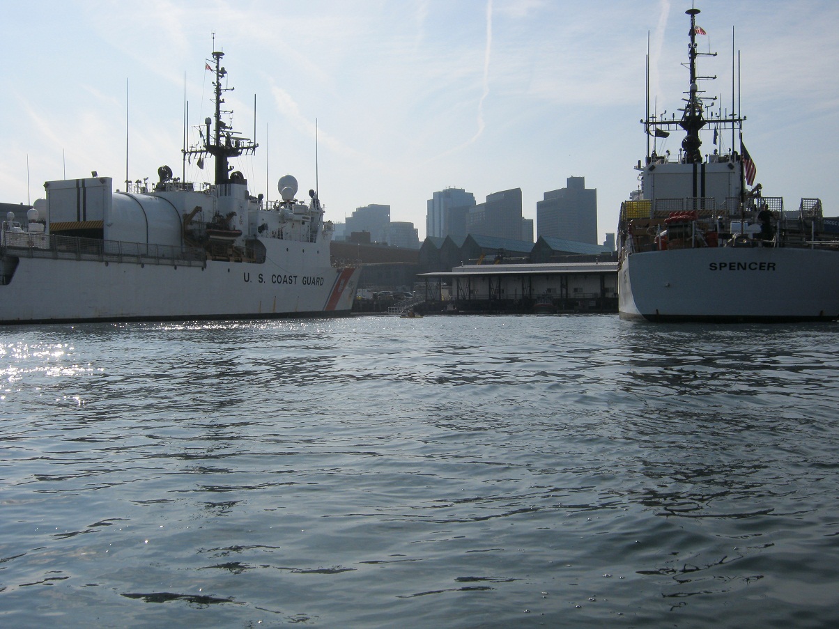
Coast Guard Station

Just past the North End you will pass the US Coast Guard Base Station.  There were a couple large ships in port with everyone on board undoubtedly preparing for what will be a busy week once Hurricane Sandy arrives.  After admiring the Coast Guard ships we paddled across the mouth of the Charles to admire a ship that is a little older.  The USS Constitution sits behind a large barrier warning you that they will use force if you get too close(see sign).  We decided not to test them and admired from a safe distance.

USS Constitution


Next we headed into the mouth of the Charles river.  In order to get further upstream we needed to pass through the locks.  I am told these locks can be fairly treacherous for kayakers in the Summer months when there is lots of power boat traffic.  Fortunately for us there we no power boats to contend with on this day.  There are a couple locks, I believe the one on the right is for commercial boats, we entered on the left.  In order to get the lock attendant to open the locks you need to signal him with 2 long and 2 short blasts from an air horn or whistle.  The attendant sits in the catwalk above the locks.  Once the doors opened we entered the lock and held on to the side while the water rose.  We were in there at low tide so the water only rose a couple inches, was pretty anti-climatic actually.  Soon the door on the other side of the lock opened and we were out into the Charles River.

Entering the lock

In the lock


I have to say it was pretty cool paddling under the Zakim Bridge.  I worked in Boston though the peak of the Big Dig and watched as the bridge was constructed and have crossed the bridge thousands of times on my way to work.  Nice to see it from a different perspective.  The are a couple more bridges to paddle under before the river opens up to the basin.  The last bridge is just before the Museum of Science which requires you to navigate a narrow channel that you will undoubtedly be sharing with power boats.  In our case it was Duck Boats.  For those who don't know duck boats are WW2 era amphibious vehicles that are now used to ferry tourists around Boston.  They are everywhere in the Charles, luckily they don't move very fast or create much of a wake but in a narrow channel with waves bouncing off the sides it can get a little hairy.  Luckily we made it through unscathed.


We paddled about a a mile further upstream until we got to the DCR Hatch Shell where we pulled up on shore for a break before heading back the way we came.  The wind started to pick up a bit on the way back, with that and the boat traffic I have a couple waves wash over my bow so I was glad to have my spray skirt on.  This trip was about 7 -1/2 miles round trip and we were out for about three hours.  Nice urban paddle to finish up the season with lots to see along the way. 
   

Monday, September 19, 2011

Boston Harbor Kayak Trip - Thompson and Spectacle Islands


View Boston Harbor Islands in a larger map

One of my goals for this season was to put my kayak in the ocean.  One of my co-workers kayaks pretty frequently in Boston Harbor and we have been trying to schedule a trip all season.  Finally this weekend our schedules meshed and we were able to get out there.  Our plan was to put in in South Boston and paddle to Thompson Island and then on to Spectacle Island.  I have been checking the weather forecast all week as it was supposed to cool off a bit. I was not concerned about the temperatures as much as the wind.  Up until Saturday night the forecast was saying 5 - 10 mph winds.  When I woke up Sunday morning the forecast changed to 15 - 20 mpg winds.   Supposedly my new kayak is built for this kind of weather so I headed out in spite of my better judgement.

We arrived at Pleasure Bay Park at 9am.  Pleasure Bay Park is located on the South West corner of Pleasure Bay on William J Day Boulevard.  There is a good sized parking lot at the park and a short walk down the beach to the water.
Beach at Pleasure Bay Park looking toward Thompson Island
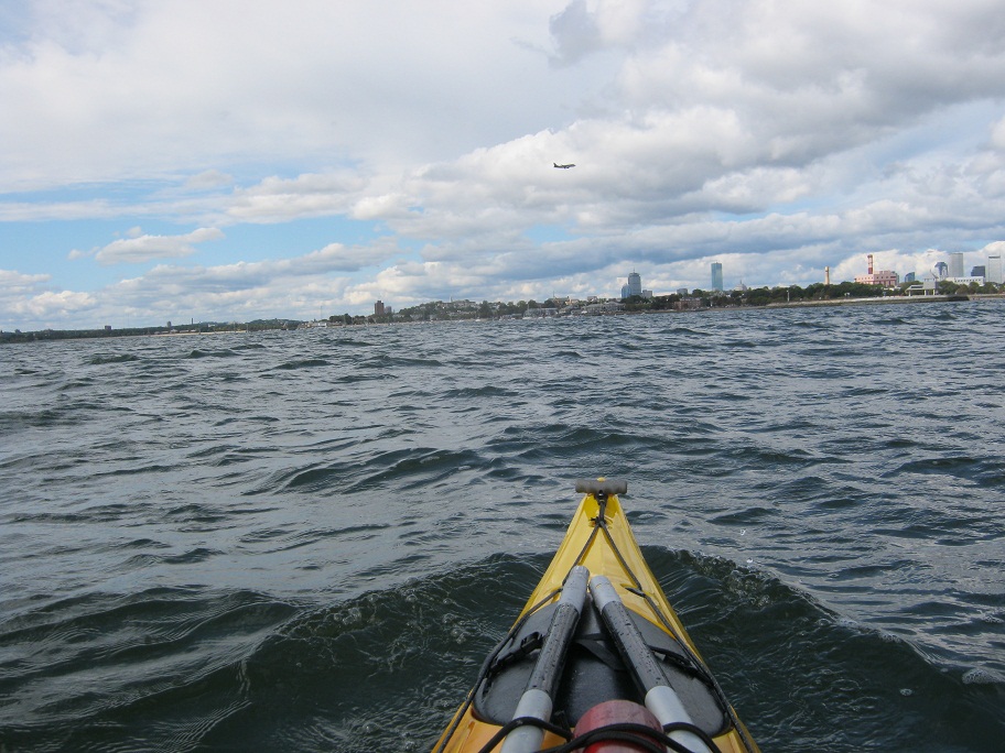
The wind wasn't too bad as we headed out but about a quarter of a mile into our paddle to Thompson Island it started really picking up.  The wind was blowing at least 15 mpg right into our faces.  This made paddling a bit of a workout to say the least.  The paddle across to Thompson Island is just over a mile.  Thompson is a private island that is currently home to an Outward Bound Education Center.  We hiked around the island a bit and saw some of the climbing apparatuses...not for one afraid of heights.  Historically the island was home to a farm and trades school from the early 1900s to about 1970.

Thompson Island looking toward Boston
North East side of Thompson Island looking toward Spectacle


After hiking around the island for a half hour or so we headed over to Spectacle Island.  We paddled around the northern tip of Thompson Island straight across to Spectacle.  The trip across was just under a mile and a half and we were again going into the wind.  We also needed to cross a shipping channel.  This late in the season the boat traffic was pretty light but we did need to wait for a ferry and a large pleasure boat to pass before we made our way across the channel. 

Top of North drumlin looking toward Deer Island

North drumlin looking at visitor center and Long Island

We landed on Spectacle Island just to the left of the pier.  Spectacle Island has an interesting history.  In the mid 1800s it houses a couple hotels that were closed due to illicit activities.  It then became a horse rendering facility and a city dump which was active until almost 1960.  In the 1990s the excavated dirt from the Big Dig Central Artery Project was used to cap and resurface the island.  The island opened to visitors in 2006 as a recreational park.  There is a ferry that runs to the island is Spring, Summer and Fall.  The island also has a visitor center with a seasonal restaurant / snack bar.   There island consists of two large hills or "drumlins".  We hiked to the top of the north drumlin and the 360 degree views were great.  The city skyline on one side and the outer harbor islands on the other.


After hiking back down we headed back to South Boston with the wind at out backs which made the paddle much much more enjoyable.  I was really able to test my new kayak on this trip in conditions that it was made for.  My paddling partner who kayaks in the harbor almost exclusively has a kayak a bit shorter and higher volume than my Avatar and I found myself having to stop and wait for him.  This was in no way due to my superior paddling ability but exclusively the speed of my kayak.  I am very impressed with how fast it is especially in rough conditions.

Total distance of this paddle was about four and a half miles.  We were out in the harbor for about 3 and a half hours.  We probably spent less than 2 hours actually paddling the rest of the time was spent exploring the islands.  It was great to finally get into the ocean and experience some real waves and rough conditions.  There are about a dozen more islands out in the harbor to explore. I just wish the season wasn't coming to an end.  Looking forward to getting out there at least once more this year and will have something to look forward to in the spring.