A group of river advocates and local politicians recently completed a source to sea trip on the Merrimack River. Their mission was to bring attention to the sewerage outflows that happen at treatment plants along the river when a large rainstorm occurs. Some plants do report these outflows but many do not. Many of the politicians on hand are sponsoring legislation to require reporting. Ultimately the group would like to eliminate the outflows entirely but that is a much more expensive undertaking.
Although I have not kayaked much recently I love to read stories about groups trying to bring attention to the great resource that the Merrimack Rive is. Link to the article below:
Lowell Sun Article
Sunday, August 11, 2019


Thursday, May 2, 2013
The Kayaking Season That Wasn't
At this time last year I had already taken a couple kayaking trips, this year not so much. Three weeks ago while trying to install a steel door in my basement, the door fell on my foot. It shattered my big toe and fractured the middle one.
So no kayaking for me anytime soon, The doctor says I should be completely healed in three or four months. I am hoping to get back in the kayak before that but for now I am not supposed to get it wet so Merrimack River water is definitely out of the question.
I probably won't be posting any trip reports anytime soon but will be living vicariously through the other kayaking bloggers out there.
So no kayaking for me anytime soon, The doctor says I should be completely healed in three or four months. I am hoping to get back in the kayak before that but for now I am not supposed to get it wet so Merrimack River water is definitely out of the question.
I probably won't be posting any trip reports anytime soon but will be living vicariously through the other kayaking bloggers out there.
Sunday, October 28, 2012
Boston Harbor Kayaking Trip - Fort Point Channel to Charles River
View Boston Harbor / Charles River in a larger map
My kayaking trips have been few and far between this year due to my wife and my new little bundle of joy. I thought my kayaking was done for the season until a kayaking buddy called last week to see if I could make it out for a trip to Boston Harbor, through the locks and into the Charles River. With hurricane Sandy about to blow in and my wife letting me out of the house for the afternoon, I had to jump at the chance.
 |
| Fort Point Dock |
Our put in for the trip was the new Fort Point Channel dock off Necco Street in South Boston. I used to work right around the corner form the dock but had not had the opportunity to use it. To get to the dock you need to enter a pay parking lot but there are some spots near the dock that they let you use for free if you are a kayaker.
 |
| Financial District |
 |
| Entering the Harbor |
The weather was perfect for our trip, sunny, mid 60s and no wind. We headed out into the channel around noon passing under the Summer, Congress, Seaport and Northern Ave bridges then into the harbor. There is quite a bit of ferry traffic in the harbor so we hugged the shore past the financial district and the North End.
 |
| Coast Guard Station |
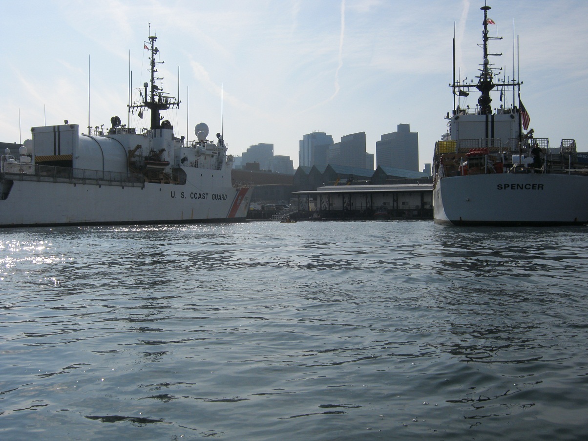
Just past the North End you will pass the US Coast Guard Base Station. There were a couple large ships in port with everyone on board undoubtedly preparing for what will be a busy week once Hurricane Sandy arrives. After admiring the Coast Guard ships we paddled across the mouth of the Charles to admire a ship that is a little older. The USS Constitution sits behind a large barrier warning you that they will use force if you get too close(see sign). We decided not to test them and admired from a safe distance.
 |
| USS Constitution |
Next we headed into the mouth of the Charles river. In order to get further upstream we needed to pass through the locks. I am told these locks can be fairly treacherous for kayakers in the Summer months when there is lots of power boat traffic. Fortunately for us there we no power boats to contend with on this day. There are a couple locks, I believe the one on the right is for commercial boats, we entered on the left. In order to get the lock attendant to open the locks you need to signal him with 2 long and 2 short blasts from an air horn or whistle. The attendant sits in the catwalk above the locks. Once the doors opened we entered the lock and held on to the side while the water rose. We were in there at low tide so the water only rose a couple inches, was pretty anti-climatic actually. Soon the door on the other side of the lock opened and we were out into the Charles River.
 |
| Entering the lock |
 |
| In the lock |
I have to say it was pretty cool paddling under the Zakim Bridge. I worked in Boston though the peak of the Big Dig and watched as the bridge was constructed and have crossed the bridge thousands of times on my way to work. Nice to see it from a different perspective. The are a couple more bridges to paddle under before the river opens up to the basin. The last bridge is just before the Museum of Science which requires you to navigate a narrow channel that you will undoubtedly be sharing with power boats. In our case it was Duck Boats. For those who don't know duck boats are WW2 era amphibious vehicles that are now used to ferry tourists around Boston. They are everywhere in the Charles, luckily they don't move very fast or create much of a wake but in a narrow channel with waves bouncing off the sides it can get a little hairy. Luckily we made it through unscathed.


We paddled about a a mile further upstream until we got to the DCR Hatch Shell where we pulled up on shore for a break before heading back the way we came. The wind started to pick up a bit on the way back, with that and the boat traffic I have a couple waves wash over my bow so I was glad to have my spray skirt on. This trip was about 7 -1/2 miles round trip and we were out for about three hours. Nice urban paddle to finish up the season with lots to see along the way.
Sunday, June 17, 2012
Father's Day on the Spicket River
View Father's Day on the Spicket River in a larger map
I think I may have mentioned on this blog in the past that my wife is an "inside girl". Kayaking isn't really her thing but on Father's day she grudgingly obliges. Last year we kayaked the Ipswich river and that was a little long of a paddle for my wife so she pleaded for a shorter paddle this year. So the Spicket it was. My daughter, who is now 4, is much more excited about kayaking now that she is a year older and had been looking forward to our special trip.

Someone posted a comment on this blog that they had used a put-in off Lowell Street in Methuen so I wanted to check it out. My regular put-in, at the end of Pine Street is pretty good, but it is right behind a private business so I am always worried that my car will get towed. The Lowell Street put-in is just before the turn for pine street. There is a large public parking lot and a very short walk to the water. The only issue with the put in is there is a 3 foot retaining wall that you will need to climb down to get to the water. It wasn't that bad actually, even with a four year old. There were some pipes stuck into the ground at the top of the wall giving you something to hold onto while climbing down.

As we were heading out, Joyce Godsey, one of the members of the Methuen Rail Trail came by to take our picture. They have been working hard to promote the Rail Trail and the River for kayaking so she was excited to see us out there. After our photo op we headed upstream toward the bird sanctuary. We were paddling against the current but the Spicket moves so slow it is barely noticeable. Lots of wildlife on this trip. We saw Great Blue Heron, red winged blackbirds, turtles and a couple river otters.

When I paddled this section of there river last year there was a large tree across the river just past the heron rookery. It seems that someone has removed the tree making it possible to now paddle upstream into New Hampshire. On this trip we paddled a few hundred yards past the Hampshire Road bridge although the map above does not show it since the battery on my iPhone died. There is another tree across the river at this point. We paddled up to it today and it looks like I could have easily paddled through, this wasn't the case last year so I have a feeling someone has done some work on this tree as well. I may have to take a solo trip sometime soon just to see how far upstream I can actually paddle. Our trip back was slightly faster with the current pushing us along.

Total distance paddled was 4 miles and we are on the water for about an hour and a half. Not a bad way to celebrate Father's day with my girls.
Saturday, June 2, 2012
Seabrook / Hampton Harbor Kayaking Trip
View Seabrook Harbor in a larger map
I took another trip this past Wednesday evening with the NE Seacoast Paddlers Meetup Group. This was a much smaller group than the last trip I took with these guys. I don't typically paddle after work but this was a nice short paddle and this was an area that I have been wanting to explore. The put in for this trip is just south on the drawbridge in Seabrook NH on route 1A. The plan for the trip was to paddle into Seabrook harbor and into the Blackwater River which flows into Salisbury MA. The plan was to paddle a few miles up the river and then come back with the out going tide.

We met at the put-in just before 6:30, weather was overcast and humid with a chance of thunderstorms. We checked the forecast before we left and determined it was safe to go out as the storms would not pass directly over us. This put in was pretty good for kayaks. There is plenty of parking, restroom facilities and a short walk down the beach to the water. The trip was planned just before high tide as to have the most water for our trip and to ride the outgoing tide back in.

Our group of 7 paddlers headed out just after 6:30. The first thing you notice upon heading out in the harbor is the Seabrook Nuclear Power Plant lurking in the distance. A bit ominous to see it sitting out there in the middle of the marsh. Just a couple hundred yards into our paddle a newbie on the trip somehow capsized his kayak. Luckily for him the water was fairly warm and the trip leader had some impressive rescue skills. I have seen an assisted rescue performed in a pool but never in an actual situation. It was good to see how easy it was for him to get this fairly heavy guy back in his boat. Definitely a skill I need to work on in the future.

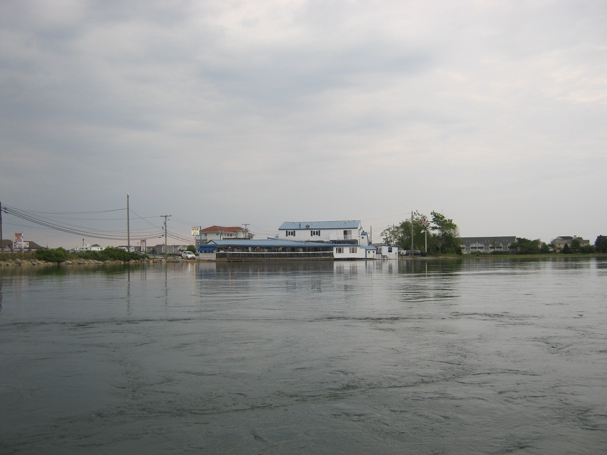
Even at high tide there were some fairly shallow spots in the harbor. One particular area to watch out for is marked my large wooden poles. Apparently there are some submerged walls that are used to hold the sand back so that they don't have to keep dredging the harbor. I assume at low tide you would need to paddle around this section. After paddling a few hundred yards into the harbor we headed south into the Blackwater river. About a mile into the river we encounter the bridge at route 286. This is also the site of the famous Browns and Markeys seafood shacks. The tide was still pretty high going under the bridge which required either ducking or leaning back on my deck to pass under without hitting my head. I believe after passing under the bridge we entered Salisbury MA.
 |
| Markeys |

Total distance of this trip was just under 6 miles and we were on the water for 2 hours. This was a nice quick little after work paddle. I think this section can be paddled at any time but it is easier at high tide. Great trip with a great group of people, looking forward to my next paddle with them.
Monday, May 28, 2012
Odiorne Point Kayaking Trip - Little Harbor and Sagamore Creek
View Odiorne Point, Rye NH in a larger map
I have driven by Odiorne Point in Rye, New Hampshire a bunch of times in the Spring and Summer and it always seems to be crawling with kayakers. Not being familiar with the tides and currents in the area I have always been hesitant to make the trip. The NE Seacoast Paddlers Meetup Group had a trip planned from Odiorne this past weekend so I couldn''t pass up the opportunity to paddle some new waters. The plan for the trip was to put in a few hours before high tide, paddle into Little Harbor and the up Sagamore Creek. There was an option to stop at a restaurant along the river for lunch/dinner and then paddle back out when the tide turned.

The put in at Odiorne Point State Park was pretty good. There was a large parkhing lot which was pretty full by the time the 40 or so paddlers in our group arrived. The address of the put in is 505 Ocean Boulevard (Route 1A) Rye NH. Coming from the south it is just before the small bridge in Rye. The is actually another informal put in on the other side of the bridge that I saw a few people using. The ramp itself was a bit muddy, I almost lost a shoe along the edge of the ramp.
 |
| Wentworth by the Sea Hotel |
 |
| Wentworth Golf Club |
We set out around 1pm, I though the initial paddle out into the harbor would be tough with the tide coming in but it was pretty easy paddling, We paddled north past a nice golf course on the left and toward the Wentworth by the Sea Hotel on New Castle Island. There is a large Marina on the island but there was not too much boat traffic, a bit surprising being Memorial Day weekend. The trip leaders directed us to pass under the (Route 1B) bridge on the right. The current under the bridge was pretty strong, kind of fun to get shot through.
 |
| Shooting Under the Bridge |
 |
| Playing in the waves |
Once the group was through we pushed further north toward the Portsmouth Naval Shipyard and around a couple small islands. One area to watch out for is a small ledge that the incoming tide was flowing over. A couple brave souls from our group paddled over it and had a rough time getting back. I briefly considered giving it a shot but after watching a couple guys struggle I decided to conserve my energy.
 |
| Portmouth Naval Prison |
Once around the islands we let the incoming tide push us up the Sagamore Creek. At the mouth of the Sagamore is the Wentworth-Coolidge Mansion. This structure dates to the 1700s and is the former home of the first Governor of New Hampshire. The Sagamore itself has a few shallow spots at the mouth but a little speed will push you through. We paddled about 2 miles upstream where it opens up a bit and the area appears to be surrounded by conservation land.
 |
| Lots of rocky shoreline |
 |
| Wentworth Coolidge Mansion |
 |
| Cold Water...Crazy Kids |
 |
| deer!!! |
Sunday, November 6, 2011
Merrimack River Kayaking Trip - Scruender Park, Methuen to Pines Recreation Area, Groveland
View Methuen to Groveland in a larger map
After the freak snowstorm we had last weekend I thought my kayaking season might be over. But the weather warmed up enough for me to get out on the Merrimack this morning. Temperatures were in the high 40s when I put in but quickly warmed up to the mid 50s, pretty comfortable kayaking weather. Wind was pretty light but picked up a bit toward the end of my trip.
I was looking forward to some foliage paddles this season but I somehow seemed to miss it. Colors now appear to be varying shades of yellow. I was hoping with most of the leaves gone from the trees I might see an eagle in the trees but none seemed to be around this weekend. There was a lone Great Blue Heron, some cormorants and ducks still hanging out. Water levels are still pretty high with a brisk current I am paddling at an average of 5 mph.

I paddled around the back side of a small island just past the 2nd 495 bridge and found myself in a short narrow little area (below) that reminded me a bit of the Ipswich River. It was pretty shallow so I am not sure this section could be paddled in the summer but it was nice to get out of the sun and wind for a few minutes.

My destination for this trip was the Pines Recreation Area boat ramp in Groveland. I stopped here for a break on a trip a few weeks ago and chatted up an older gentleman working there. I think the ramp is for Groveland residents only but I couldn't find any information on it. The ramp was gated off for power boats but no problem for someone carrying a kayak. There is a nice flat ramp and parking area just a short walk away. My typical takeout is at Riverside Park in Haverhill. The problem there is you need to climb a fairly steep flight of stairs to get to the parking lot. Not always an easy feat after a couple hours of paddlng. The Pines Recreation Area is just about a mile past the Haverhill and I may try using it again in the future as long as nobody kicks me out as I am not a Groveland resident.
 |
| Pines Recreation Area |
Total mileage of this trip was just over 10 miles and I completed the trip in 1 hour and 50 minutes.
Sunday, October 23, 2011
Merrimack River Kayaking Trip - Mouth of the Merrimack Seal Paddle
View Mouth of the Merrimack in a larger map
I have been wanting to get out into the mouth of the Merrimack for a while now but have been a bit hesitant to get out there without someone with some experience. This area is a large tidal expanse that can get a bit dangerous when the tides are coming in or going out. I recently found that Plumb Island Kayak offers guided tours of the area and one of the tours even makes a trip out to see some seals. So I gave the guys at Plumb Island Kayak a call and they told me they had some availability in a tour going out Sunday afternoon.
 |
| Pu in / Take out |
The put-in for this trip was a private ramp right behind Plumb Island Kayak. This trip is usually planned just before low tide so as to ride the tide out to the seals and the tide the incoming tide back. I would be paddling with a group of about 15 college students and there were 4 guides on the trip. Weather today was a little cool - mid 50s but there was no wind, pretty much perfect conditions.
 |
| First Seal Sighting |
Our destination was Badgers Rocks where the seals tend to congregate at this time of the year. We headed out across the river to the Salisbury side and hugged the shore for about three miles as we headed toward badgers Rocks. As we approached the rocks we could see at least a dozen seals on the the rocks. We approached slowly but as we got closer the seals ungracefully made their way off the rocks and into the water. As we just drifted past we would see numerous little heads popping up to check us out. We drifted around in the area for about a half hour and just watched the seals popping up and down. Every once in a while one of the would slap its tail at us warning us that we were too close.
 |
| Close up of a big guy |
Soon the sun was going down and it was getting cold so the group headed back. Total distance of this trip was just over 6 miles and we were out on the water for about 2 and a half hours. This was a great late season trip, definitely will be paddling this section of the river again.
 |
| View of the Mouth looking toward the ocean |
Sunday, October 16, 2011
Merrimack River Kayaking Trip - Methuen to Haverhill

My put in for this trip was Scruender Park in Methuen. Water levels are still very high and thus the current is strong making for an average speed of 5.2 mph (based on my gps). I thought about paddling upstream a bit but a taste of headwind in my face and I quickly thought better of it. The wildlife on the river was pretty sparse today. I saw a couple cormorant, a few pairs of ducks and a lone great blue heron. Unfortunately no eagle sightings today.


Monday, October 10, 2011
Merrimack River Kayaking Trip - Scruender Park, Methuen MA to Cashman Park, Newburyport MA
One of the reasons that I purchased my Perception Avatar kayak was so that I could take longer trips. Anything over 10 miles in my 11 foot Necky and I was done. One trip in particular that I was looking forward to is the trip from Schruender Park in Methuen to Cashman Park in Newburyport. I have paddled this stretch of river in two separate trips but it had been my goal to paddle the entire stretch as a day trip. Total mileage of this trip is just about 23 miles so it is a trip that takes a bit of planning including leaving a car in Neburyport or having someone who will pick you up. For me the one good thing about having a wife that doesn't really like to kayak is she is always available to pick me up at the end of my trips.
Due to the increasing boat traffic after Haverhill I didn't want to attempt this trip during the summer. I have been warned that things can get pretty crazy downstream with all of the marinas. You also need to time the tide right so you are not paddling against and incoming tide. The rule of thumb is to hit Haverhill just about at high tide.
This past Sunday everything seemed to line up perfectly for my trip with a high tide at about 10:30am. I put in in Methuen around 9:00am, weather was cool with no wind and forecast to warm up to the mid 80s later in the day. The first 10 or so miles of my trip went great I was making good time but I did notice that my kayak seemed to be pulling to the left a little. I assumed I must have bent the skeg a little at put in, something I could straighten out when I stop for lunch. Once I got past Haverhill the boar traffic started to pick up significantly no doubt because of the unseasonably warm weather. A bad omen was the three large and extremely loud powerboats like the one below that screamed past me.

At about the 15 mile mark my left arm was really starting to get sore from correcting strokes needed due to the bent skeg so I decided to stop for lunch and see what I could do about it. I was able to straighten it out a bit but it was still pulling a little but I decided to power on. Boat traffic continued to increase as I headed downstream making crossing the river a bit precarious. I wanted to be on the left side of the river when I got to the Route 95 bridge so I could paddle north around the islands in Newburyport / Salisbury, The last time I paddled this section I was on the right side of the river and wasn't able to get across due to the strong current and tide.
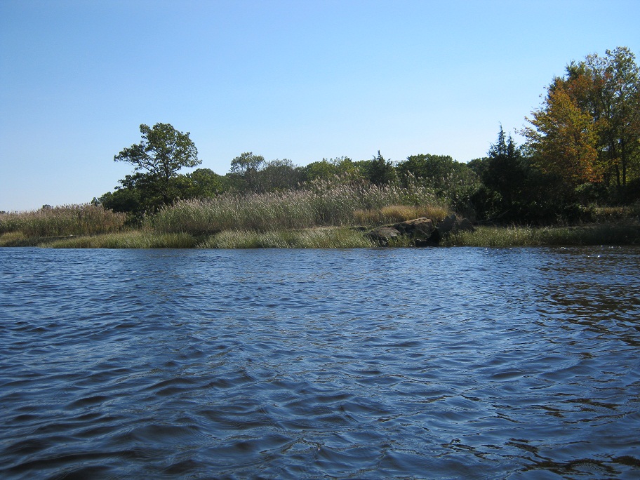
This time around I was able to stay north of the islands and was treated to less boat traffic and some really nice scenery along Deer, Eagle, Carr and Ram Islands. Quite a contrast to the marinas and the hundreds of boats on the other side of the islands. I planned to paddle north around Ram island but was pretty tired at this point so I cut between Carr and Ram Island headed across the Mariana and into the boat Launch at Cashman Park to finish up my day.
 |
| Eagle Island |
 |
| Carr Island |
 |
| Between Carr and Ram Island heading toward Cashman Park |
Total mileage of my trip was just under 23 miles and I was on the water for just over 5 hours. I have some pretty sore arms and shoulders today but I am glad to have completed the trip at least just to say that I did it. The area around the islands in Newburyport is really nice. If I wasn't so tired at the end of my trip it would have been nice to explore a little. I guess that will have to be a trip for next season.
Monday, September 26, 2011
More On The Hooksett Wastewater Treatment Plant Disks
There were a couple interesting articles in the Lawrence Eagle Tribune this week about the spill this past March that released millions of plastic waste water filtration disks into the Merrimack River. The first article is about the steps they are taking in Hooksett to prevent something from happening again.
Taking steps to prevent another disk incident in the Merrimack
The second article is about a gut from Merrimack MA who has picked up 12,000 of the disks on a short stretch of the river.
The 12,000 Disk Man
Sadly, despite the new measures put in place and the cleanup efforts of many I fear we will be finding these disks in and along the Merrimack for years to come.
Taking steps to prevent another disk incident in the Merrimack
The second article is about a gut from Merrimack MA who has picked up 12,000 of the disks on a short stretch of the river.
The 12,000 Disk Man
Sadly, despite the new measures put in place and the cleanup efforts of many I fear we will be finding these disks in and along the Merrimack for years to come.
Seals Sneak Spray Skirt Review
When I purchased my new kayak earlier this month with plans for taking it into the ocean I knew I would be needing a spray skirt. I went back and forth regarding getting a neoprene or nylon model but finally settled on nylon as every time I see someone trying to attach a neoprene skirt they always seem to be struggling or asking for help. Since I spend a fair amount of time paddling solo I needed something easy to get on.
After a bit of research I settled on the Seals Sneak Spray Skirt. This skirt is advertised as a recreational skirt for light to moderate conditions. It has a lot of great features but at the top of the list is that it can be purchased for under $90.
Some of the features of this skirt are:
- Detachable Suspenders
- Tensioned deck stay
- Zippered Front
- Mesh Pockets
- Comfortable Neoprene Waistband
I had a chance to use this skirt a few weeks ago in some pretty windy conditions in Boston Harbor. The waves were between 2 and 3 feet. A few waves washed completely over my bow and to the skirt's credit I stayed dry. This is a very comfortable skirt, I have used other skirts without suspenders and they never seem to stay in place. The zippered front of this skirt is really nice feature. This allows to to get at the contents of your cockpit and you can just unzip it and step put of your kayak without needing to reattach. Another nice feature is the pockets allowing you to keep waterproof items close at hand.
Overall a great spray skirt for short money. Probably will need to upgrade in a couple years if I ever plan on open ocean kayaking but I think this will server me just fine for years to come.
Monday, September 19, 2011
Boston Harbor Kayak Trip - Thompson and Spectacle Islands
View Boston Harbor Islands in a larger map
One of my goals for this season was to put my kayak in the ocean. One of my co-workers kayaks pretty frequently in Boston Harbor and we have been trying to schedule a trip all season. Finally this weekend our schedules meshed and we were able to get out there. Our plan was to put in in South Boston and paddle to Thompson Island and then on to Spectacle Island. I have been checking the weather forecast all week as it was supposed to cool off a bit. I was not concerned about the temperatures as much as the wind. Up until Saturday night the forecast was saying 5 - 10 mph winds. When I woke up Sunday morning the forecast changed to 15 - 20 mpg winds. Supposedly my new kayak is built for this kind of weather so I headed out in spite of my better judgement.
We arrived at Pleasure Bay Park at 9am. Pleasure Bay Park is located on the South West corner of Pleasure Bay on William J Day Boulevard. There is a good sized parking lot at the park and a short walk down the beach to the water.
 |
| Beach at Pleasure Bay Park looking toward Thompson Island |
 |
| Thompson Island looking toward Boston |
 |
| North East side of Thompson Island looking toward Spectacle |
After hiking around the island for a half hour or so we headed over to Spectacle Island. We paddled around the northern tip of Thompson Island straight across to Spectacle. The trip across was just under a mile and a half and we were again going into the wind. We also needed to cross a shipping channel. This late in the season the boat traffic was pretty light but we did need to wait for a ferry and a large pleasure boat to pass before we made our way across the channel.
 |
| Top of North drumlin looking toward Deer Island |
 |
| North drumlin looking at visitor center and Long Island |
We landed on Spectacle Island just to the left of the pier. Spectacle Island has an interesting history. In the mid 1800s it houses a couple hotels that were closed due to illicit activities. It then became a horse rendering facility and a city dump which was active until almost 1960. In the 1990s the excavated dirt from the Big Dig Central Artery Project was used to cap and resurface the island. The island opened to visitors in 2006 as a recreational park. There is a ferry that runs to the island is Spring, Summer and Fall. The island also has a visitor center with a seasonal restaurant / snack bar. There island consists of two large hills or "drumlins". We hiked to the top of the north drumlin and the 360 degree views were great. The city skyline on one side and the outer harbor islands on the other.

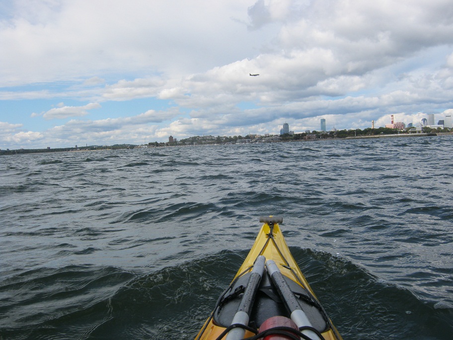
After hiking back down we headed back to South Boston with the wind at out backs which made the paddle much much more enjoyable. I was really able to test my new kayak on this trip in conditions that it was made for. My paddling partner who kayaks in the harbor almost exclusively has a kayak a bit shorter and higher volume than my Avatar and I found myself having to stop and wait for him. This was in no way due to my superior paddling ability but exclusively the speed of my kayak. I am very impressed with how fast it is especially in rough conditions.
Total distance of this paddle was about four and a half miles. We were out in the harbor for about 3 and a half hours. We probably spent less than 2 hours actually paddling the rest of the time was spent exploring the islands. It was great to finally get into the ocean and experience some real waves and rough conditions. There are about a dozen more islands out in the harbor to explore. I just wish the season wasn't coming to an end. Looking forward to getting out there at least once more this year and will have something to look forward to in the spring.
Subscribe to:
Posts (Atom)